
Massachusetts Southwest Lighthouses:
Buzzard's Bay Region
Fall River, New Bedford, Mattapoisett,
Marion, Pocasset, Bourne
Regional Blog Stories | ||
As the whaling and fishing industries brought much commerce to those cities and neighboring towns in the Buzzard’s Bay area, lighthouses were built to guide the increasing shipping traffic and mariners who were making a steady profitable living.
Massachusetts Lighthouses in the
Buzzards Bay Area
You Can Drive or Hike To
Note: The lighthouses mentioned below that you can drive to can also be viewed from various boat tours offered. Driving directions are heading in a northeastern direction.
Click any lighthouse image or link below to find out information about each lighthouse, including historical stories, directions, tours, photos, and nearby attractions.
Massachusetts Lighthouses in the
Buzzards Bay Region-
Best Viewed by Boat
Click any lighthouse image or link below to find out information about each lighthouse, including historical stories, directions, tours, photos, and nearby attractions.
Places to Visit:
In the Buzzards Bay
(Southwestern) Massachusetts Region
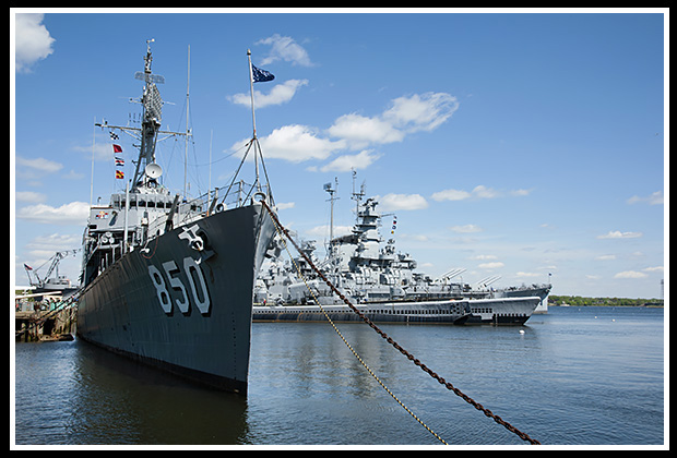 |
Fall River exhibits Battleship Cove, showcasing the world’s largest naval ship exhibit with at least five ships visitors can tour aboard. |
These vessels include the Battleship USS Massachusetts, the Destroyer USS Joseph P. Kennedy, Jr., and PT boats used in the South Pacific during World War II.
Explore the haunted Lizzie Borden Bed and Breakfast/ Museum, one of the most controversial criminal events of the 19th century.
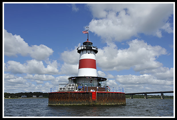
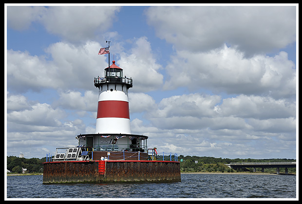
| Stay overnight at Borden Flats lighthouse and get a wonderful experience of what it's like to be a keeper, we did! Great sunset! | 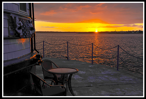
|
New Bedford’s Whaling Museum displays maritime exhibits and historical artifacts from the 19th century.
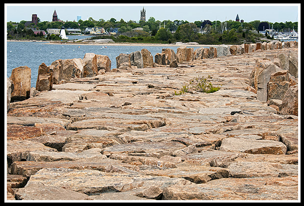 |
For those who enjoy hiking, take a good hike that spans over 9,000 feet on the largest hurricane barrier on the East Coast, protecting New Bedford Harbor. |
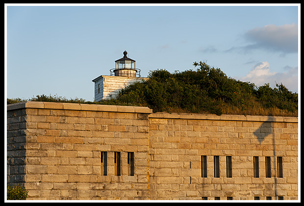
| The beginning of the hurricane wall starts at Fort Taber Park with Clark's Point lighthouse on top of the fort, and Butler Flats light can be see out in the waterway. |
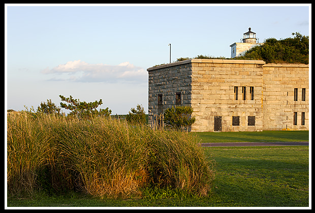
Clark's Point |
The Fort Taber park is a great place to relax to watch the boats entering or going out from the harbor, and there is a lighted boardwalk, where you may find some of the locals fishing off the edge.
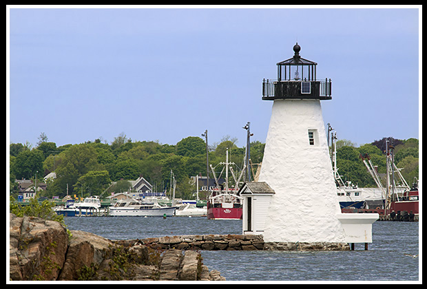
The other end of the wall ends by New Bedford Harbor, where Palmer Island light is located. |
Palmer Island Light |
Nearby, visit the 156-foot Schooner Ernestina built in 1864, which is located in New Bedford.
|
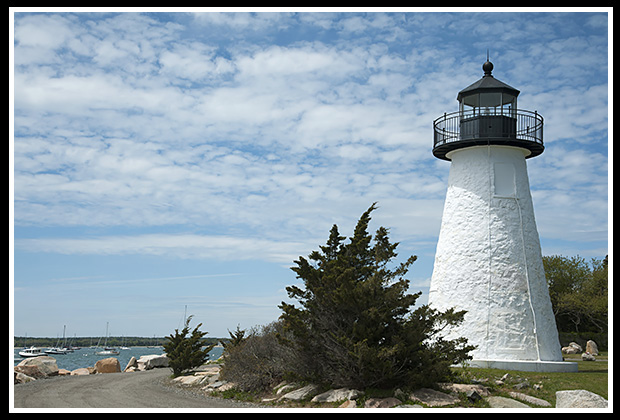
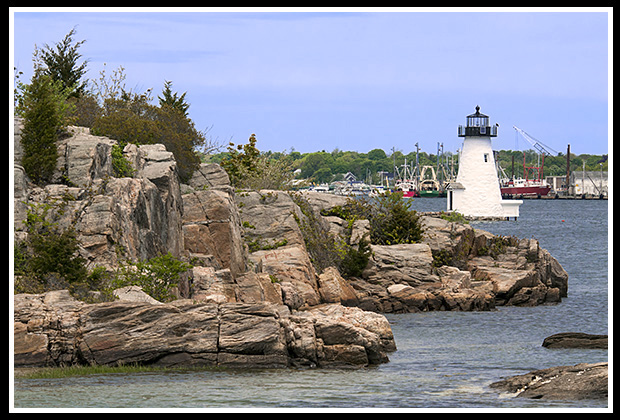
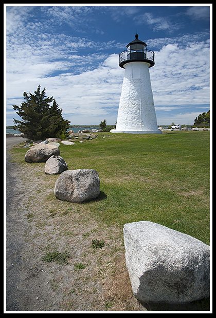
Ned’s Point Lighthouse sits in a small park, called Veterans Memorial Park, in Marion. |
It's play time! Check out the Cartwheels2 Fun Center with the largest Go Cart track in the region, including Cape Cod. Want to cool off? Visit the Water Wizz Fun Park in East Wareham.
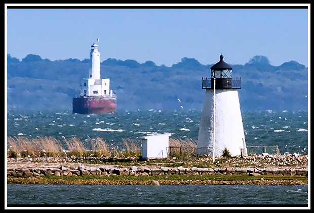 |
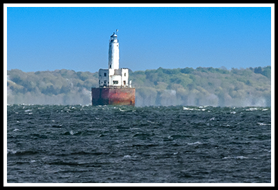
Visitors can get a distance view of Cleveland East Ledge lighthouse behind Bird Island light along the road that leads to the Kitansett Golf Course in Marion. |
All along the rural coast from Ned's Point light through Bourne, heading towards and through the Cape Cod Canal into Cape Cod, there are plenty of beaches to relax at.
| Many of these beaches are not crowded, as most tourists are looking at heading directly into Cape Cod, by-passing these scenic gems. | 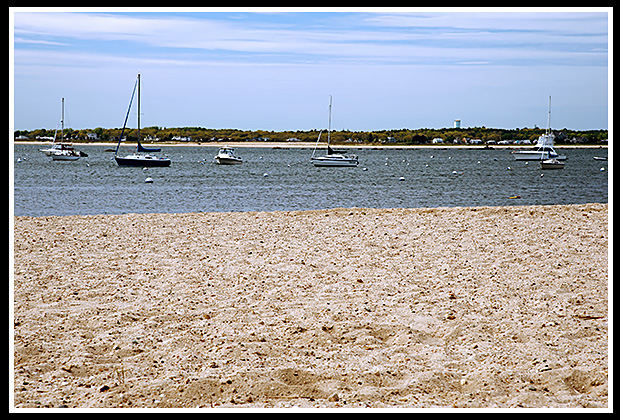 |
One of these beaches includes Queen Swell Beach. For those with families and needing a lifeguard, Hen Cove Beach is another quiet jewel with calm waters and a defined swimming area, or try Electric Avenue Beach which is on the edge of Buzzards Bay. Gray Gables Beach is another with a basketball net provided for anxious teenagers. There is also Monument Beach in Bourne, which is a popular destination, so this one can be crowded, and is located just before the entrance to the Cape Cod Canal.
In Pocasset is Barlows Landing off Route 28, which is a mid-sized quiet yet spacious beach on Pocasset Harbor. For those looking for a picture perfect quiet setting, without amenities (although lifeguards are posted), try Picture Lake, with its setting amongst pine trees for lots of sun and shade.
In Pocasset, Wing's Neck lighthouse can be viewed at the end of a small cul-de-sac, and is available year round as a rental for lighthouse enthusiasts.
Spend a relaxing day at Old Silver Beach in North Falmouth about 4 miles from Pocasset, or any of Falmouth’s many beaches.
| The Cuttyhunk Historical Society offers an annual open house to remote Tarpaulin Cove lighthouse usually in mid summer. They also staff a maritime museum of the Elizabeth Islands during the summer season. | 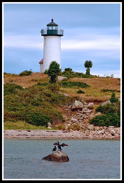 |
Cuttyhunk Island and Penikese Island are the last of the Elizabeth Islands that are mostly accessible to the public, whereas the other islands are private.
Boat Tours: Massachusetts Lighthouses
in the Buzzards Bay Region (southwest)
Boats listed below may pass by lighthouses mentioned coming to and from New Bedford Harbor as part of charters, narrated wildlife and historic tours, ferrying passengers, fishing tours and other types of excursions.
New Bedford Harbor Tours
Offers narrated cruises around New Bedford Harbor and past Palmer Island Light. Also offers a 2-hour sunset tour.
52 Fisherman’s Wharf, Pier 3,
New Bedford, MA 02740
Phone: (508) 951-0645
Email: info@newbedfordharbortours.com
Lighthouses: Palmer Island Lighthouse, Butler Flats Lighthouse, Clark’s Point Lighthouse
Cuttyhunk Ferry Company, Inc.
66B State Pier, South Bulkhead
New Bedford, MA 02740 (508) 992-0200
Lighthouses: Palmer Island Lighthouse, Butler Flats Lighthouse, Clark’s Point Lighthouse
Seastreak
Ferry from New Bedford to Martha’s Vineyard
49 State Pier
New Bedford, MA 02740
(866) 683 3779
Lighthouses: Palmer Island Lighthouse, Butler Flats Lighthouse, Clark’s Point Lighthouse
Books to Explore
New England's Haunted Lighthouses: 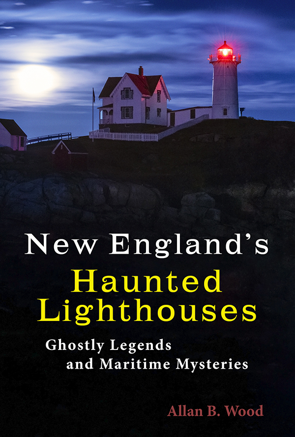
Available in paperback. |
In this image-rich book, discover the historical secrets of the haunted lighthouses of New England! Reliable witnesses have reported numerous ghostly encounters, including the spirits of dedicated keepers who refuse to leave, phantom ships, victims of misfortune, restless souls from nearby shipwrecks, and more. Immerse yourself in the tales connected to these iconic landmarks, blending maritime history with the paranormal. Discover the peaceful spirits of a keeper and a girl named Lucy at Borden Flats Light. |
Lighthouses and Coastal Attractions of Southern New England: Providing lots of special human interest stories from each of the 92 lighthouses, along with plenty of additional indoor and outdoor coastal attractions and tours in the area, with contact info to plan your trip. Look inside! |
|
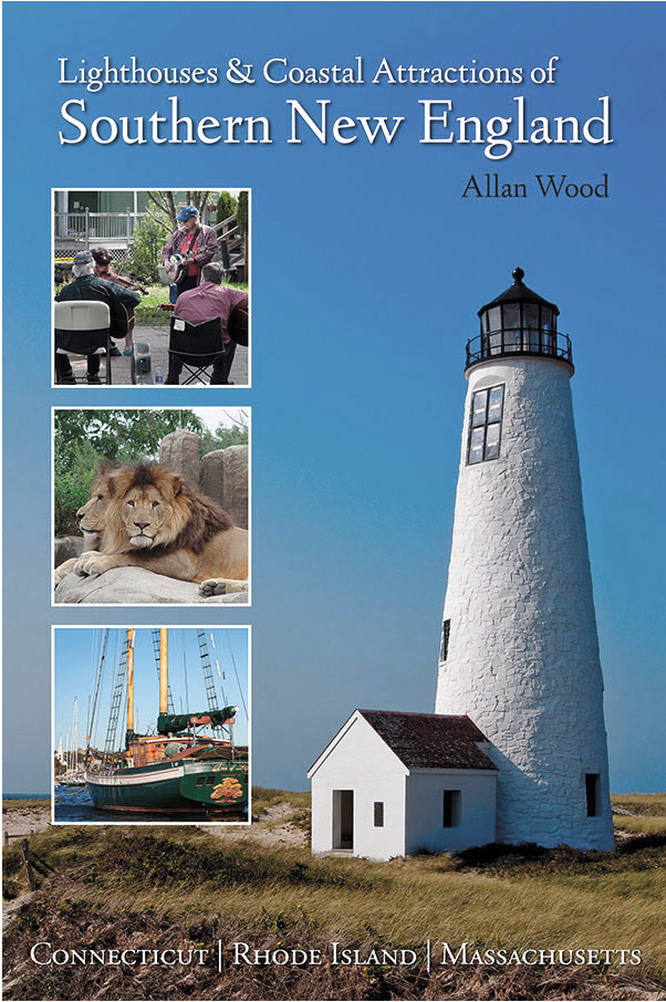
Available in paperback, hardcover, and as an eBook for all devices.
|
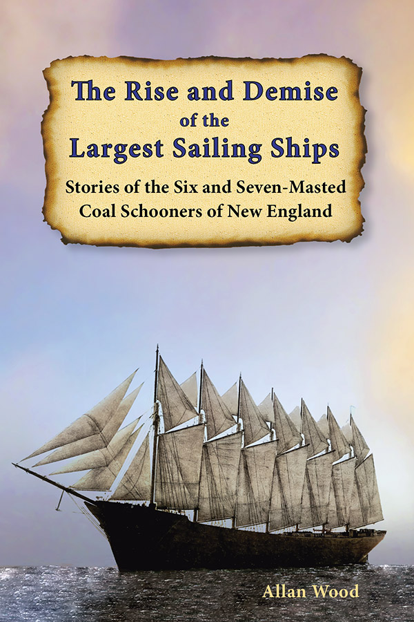
The Rise and Demise of the Largest Sailing Ships: In the early 1900s, New England shipbuilders constructed the world’s largest sailing ships amid social and political reforms. These giants of sail were the ten original six-masted coal schooners and one colossal seven-masted vessel, built to carry massive quantities of coal and building supplies, and measured longer than a football field! This self-published book, balanced with plenty of color and vintage images, showcases the historical accounts that followed these mighty ships. These true stories include competitions, accidents, battling destructive storms, acts of heroism, and their final voyages. |